A while back I decided that my Garmin GPS was not really useful as a data logger for coordinates for a few reasons, 1) it has limited battery life, 2) it is bulky to carry around, 3) it only holds 10,000 coordinates and then when you save them to the card it looses the time stamps and 4) it is very haphazard at recording points, even on record them all the time mode.
What I wanted was:
- A unit that can hold hundreds of thousands of points.
- A unit which is small and easily carried all the time.
- A unit which has good battery life.
- A unit which can record points very often say every 10 seconds.
So I went looking for a GPS. I headed off the Johnny Appleseed, where I bought my Garmin unit, they understood what I wanted, but they did not have any units such as I was after. But they did tell me I needed a data logger. This made searching the internet easier.
After this discussion I trawled the internet. There were a few units available in Australia, but they tended to be high end models and expensive or only work with Microsoft Windows. In the end I purchased a unit from the USA for $69. It is the AGL3080 GPS Photo Tracker.
I had trialled it on my balcony just to make sure it worked. I also tested getting the files and converting them from NMEA to GPX format. I am using GPS babel for the conversion and GPS photo linker for linking the data to the photos. The USB inteface makes the device look like a thumb drive which is an enormous improvement over the Garmin's arrangement.
So, last weekend I went away armed with the new unit. I took lots of photos. Over 2 days I went though about 1 and a half sets fo three AAA batteries. I had the unit turned on for 15 to 20 hours.
Back at home I was a little disappointed to discover that the unit had created about 8 files. converting them in GPS babel one at a time is slow because the interface is very clunky. I know I could probably write a Unix script to process them, but that would require a bit of learning. Maybe I will do that later.
I then loaded the files and camera raw images into the photo linker package. After a few manual tests, my worry that I would need to adjust the time turned out to be completely unjustified. So I just bulk added GPS coordinates to the images. Not only does it add the altitude, Long and Lat, but it also adds the location town, state and coutry names as well. Pretty cool, I think.
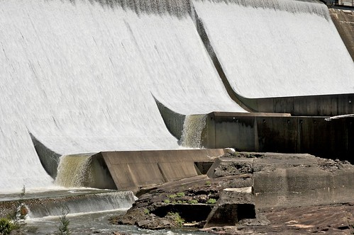
After processing my images through Adobe Bridge and Aperture, I uploaded them to Flickr and lo and behold they automatically appear on the map. I am very happy. If you click on it and then select map (near the bottom right of the page) you will see where it was taken.
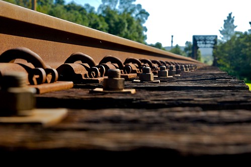
"north coast railway" by yewenyi [?]
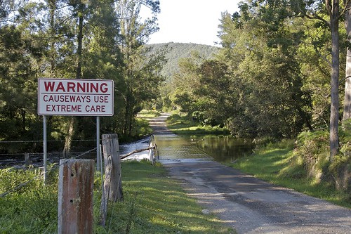
"warning- causeway" by yewenyi [?]
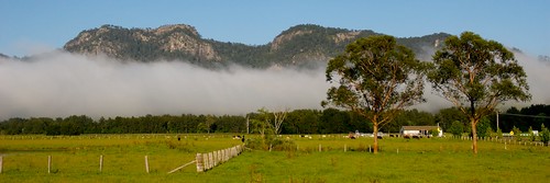
"fog bank" by yewenyi [?]

1 comment:
Thanks for the info. I just ordered one of these after discovering that the Sony CS1 doesn't work with Leopard.
You may want to look at HoudahGPS to do your conversion to GPX format. It's basically a GUI for GPS Babel, and it's free.
Post a Comment